kunanyi/Mount Wellington
Stand anywhere in Hobart and you see it. kunanyi/Mount Wellington rises 1,271 metres directly behind the city forested on its lower slopes, rocky near the summit, and dusted with snow through winter. The summit is a 20-minute drive from all four Island Collective properties, or catch the bus from Brooke Street Pier a 5-minute walk from both The Royale and The District. Guests at The Helm and The Tempo are just as well placed. For more Hobart highlights, visit The Neighbourhood guide.
Hobart's Defining Mountain
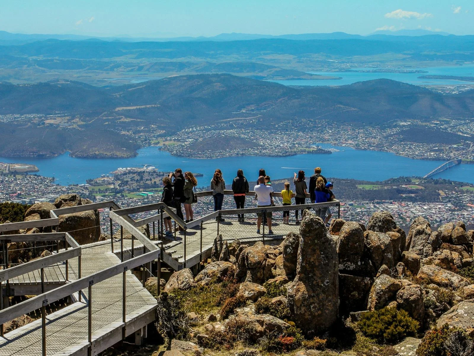
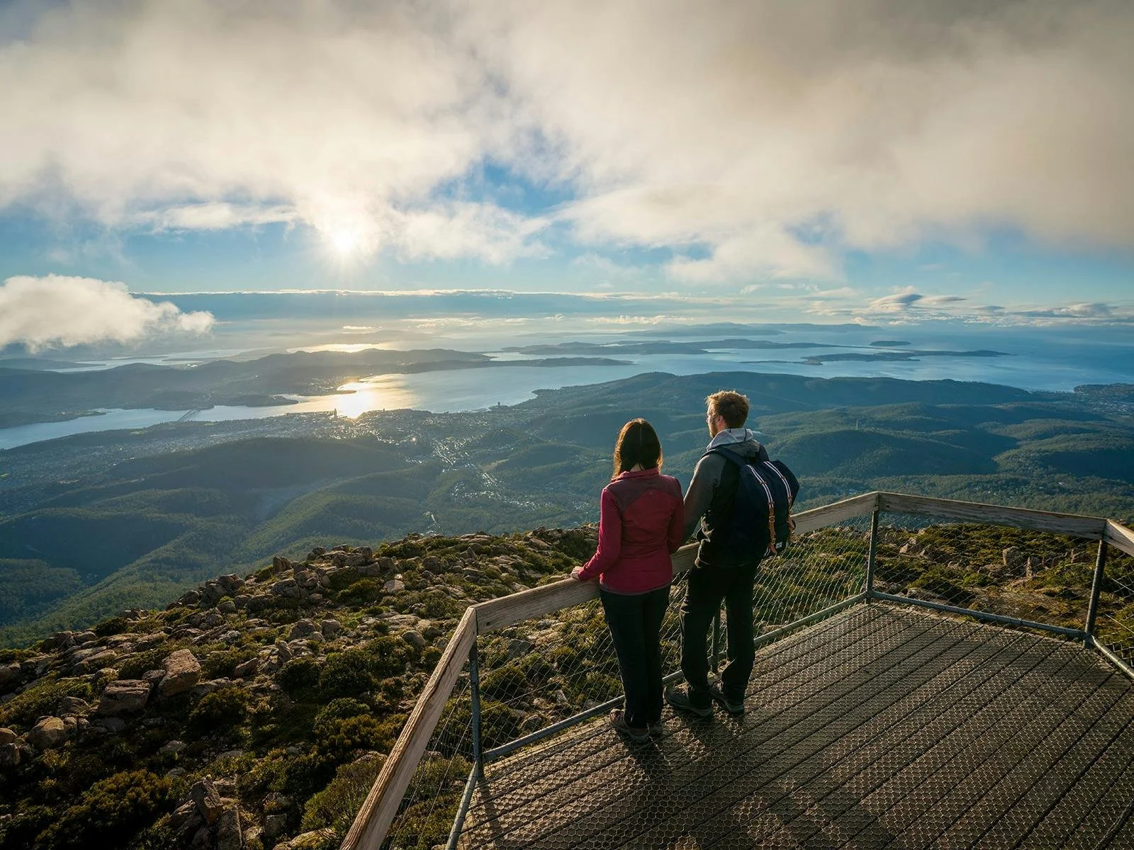
Stand almost anywhere in central Hobart and it is there the long, forested ridge that dominates the western skyline, rising steeply from the suburbs to a fractured dolerite summit at 1,271 metres above sea level. Kunanyi, known to most Australians as Mount Wellington, is not simply a scenic backdrop. It is an active, living part of Hobart's daily identity is a place where residents walk their dogs on weekday mornings, mountain bikers test their nerve on technical singletrack, and visitors from around the world pause at the summit lookout to take in one of the finest urban panoramas in the Southern Hemisphere.
Cultural Significance and the Dual Name
The Palawa people of Tasmania have known this mountain for tens of thousands of years. Kunanyi the name by which the peak is increasingly recognized, and now officially dual-named carries deep cultural significance that long predates European settlement. When navigator Matthew Flinders climbed the peak in 1798, he was not discovering something new but entering a landscape already shaped by generations of human presence and meaning. That layered history runs through the mountain quietly and persistently, and it is worth holding in mind when you stand at the summit looking south toward the distant wilderness.
Wellington Park Reserve: Trails and Natural Features
Walking Tracks Through Forest and the Organ Pipes
Today, the mountain lies within the Wellington Park reserve approximately 18,000 hectares of protected bushland beginning almost at the edge of Hobart's suburban streets. The reserve is crisscrossed by walking trails ranging from accessible family paths through cool fern gullies to demanding multi-hour alpine routes. The Organ Pipes track, which leads beneath the dramatic dolerite columns of the central escarpment, is consistently the most popular and visually impressive route on the mountain.
The Organ Pipes themselves are among the most striking geological features in Tasmania. These tall, angular dolerite columns rise in parallel rows across the mountain's southern face, formed by the slow and uneven cooling of igneous rock over 165 million years ago. From the valley below, they appear almost architectural. Photographers return repeatedly to the Pipes, and the quality of light at dawn and dusk transforms the columns entirely from season to season.
Wildlife Encounters: Wallabies, Echidnas and Rare Birds
Wildlife is abundant throughout Wellington Park. Eastern grey kangaroos, Bennett's wallabies, pademelons, and echidnas are regularly encountered in the lower forest zones at dawn and dusk. The birdlife is exceptional: the black currawong is the mountain's resident companion, while the swift parrot and the forty-spotted pardalote attract serious birdwatchers. For visitors accustomed to travelling deep into wilderness to see native fauna, the accessibility of this wildlife from a city accommodation base is a genuine and consistent source of surprise.
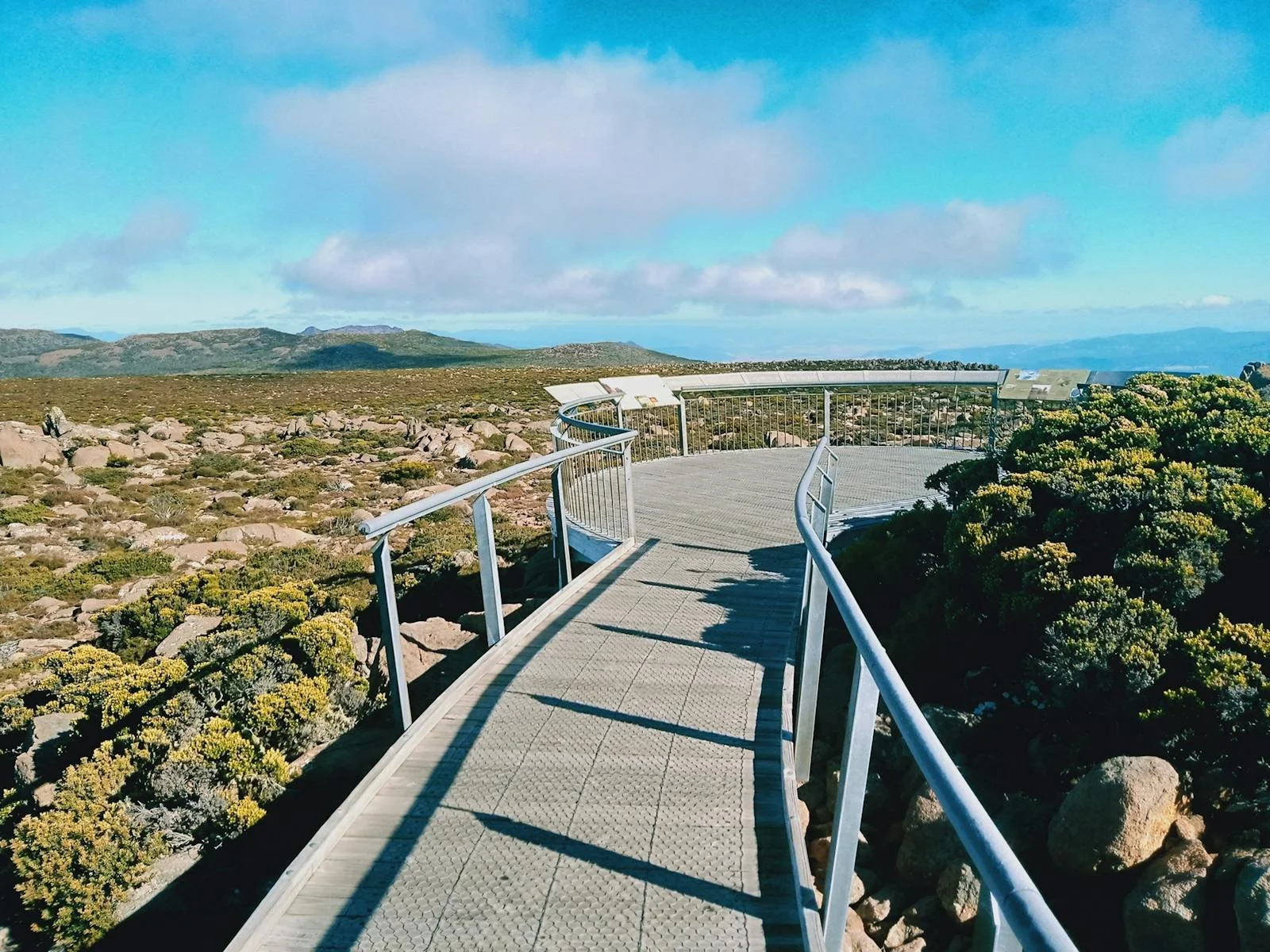
Getting to the Summit
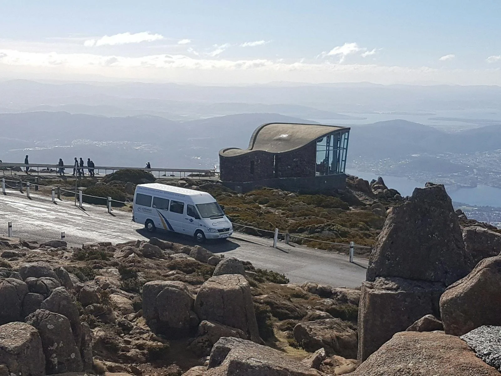
Driving the Pinnacle Road
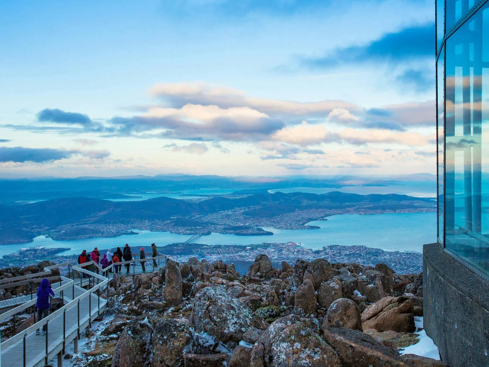
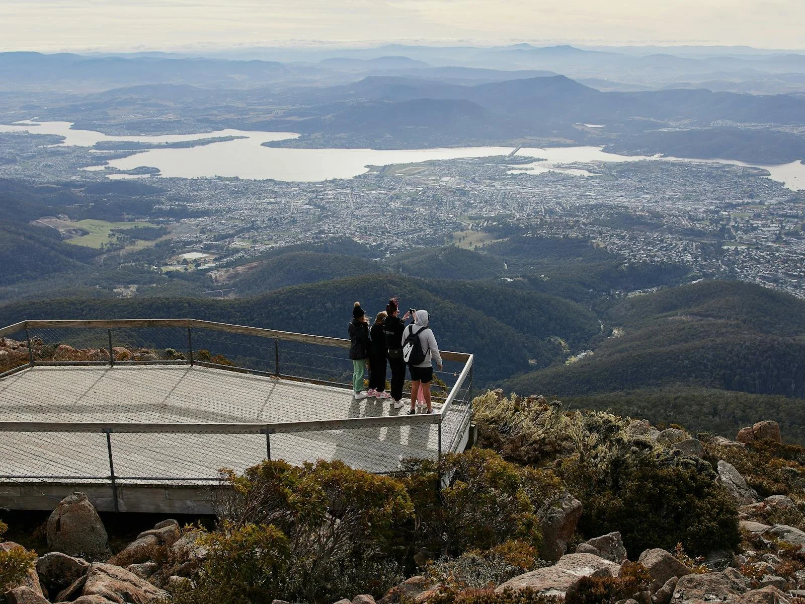
The most direct route is to drive along the sealed Pinnacle Road from Fern Tree to the summit car park at 1,240 metres. On a clear day, the view extends across the full sweep of southern Tasmania: the Derwent estuary, the patchwork farmland of the Huon Valley, and the remote dark ranges of the South-West Wilderness. All four Island Collective properties are within approximately 20 minutes of the summit by car — The Royale, The Tempo, The District, and The Helm.
Bus Access and Car-Free Ascent from the CBD
Guests at The Royale (Hobart CBD) and The District (Hobart CBD) can also access the mountain via Metro bus from near Brooke Street Pier, making a car-free summit visit entirely feasible. The bus drops at Fern Tree, from where clearly marked walking tracks lead up through the reserve. Moving through the forest layers on foot reveals the mountain at a pace that a drive cannot replicate.
Mountain Biking on the Descent Trails
Mountain biking on kunanyi has developed into a significant outdoor recreation activity. The Wellington Park trail network includes dedicated singletrack with technical descents, flowing forest lines, and sufficient variety to occupy skilled riders for multiple days. The well-regarded Descent trail drops from near the summit to the lower suburbs in a run that combines elevation, forest scenery, and the remarkable visual reward of Hobart spread below.
Weather, Seasons and What to Bring
Conditions at the summit change rapidly and often with little warning. Snow falls regularly throughout winter typically June to August and the temperature at the top is consistently colder than in the city below. Those planning a summit visit should carry warm layers, wear good footwear, and maintain a flexible itinerary. Fern gully walks near Fern Tree offer shaded, peaceful routes through cool temperate rainforest that feel entirely removed from the city, despite being fifteen minutes by car from the CBD.
After a morning on the mountain, many visitors return to the waterfront for lunch or an afternoon browse through the Salamanca Markets before a sailing on the MONA Ferry up the Derwent.